***Please click on this link Map Locations of ALL Trails on this Site to view a map with the location of every trail “2oldguyswalking” has written a review on.***
HEBER DOWN CONSERVATION AREA TRAILS REVIEW
UPDATE – November 10, 2023 – just returned from a walk here and made some changes to this review below.
UPDATE – June 25, 2019 – We just returned from a re-visit here. I noticed new signage stating that neither smoking nor even vaping is permitted on the trails. I looked it up and found that all Central Lake Ontario Conservation Authority properties are now “smoke – free”.
We just spent three days exploring a CA within five kilometers of Whitby’s City Hall and thoroughly enjoyed it ! It all started when the Wife wanted to walk somewhere “different”. She suggested Heber Down. I’d been there a few times in the past and wasn’t particularly impressed. But then, not every walk has to result in a review does it ? Well, turns out the Wife was onto something, and we enjoyed the place immensely, so here I am writing a trail review.

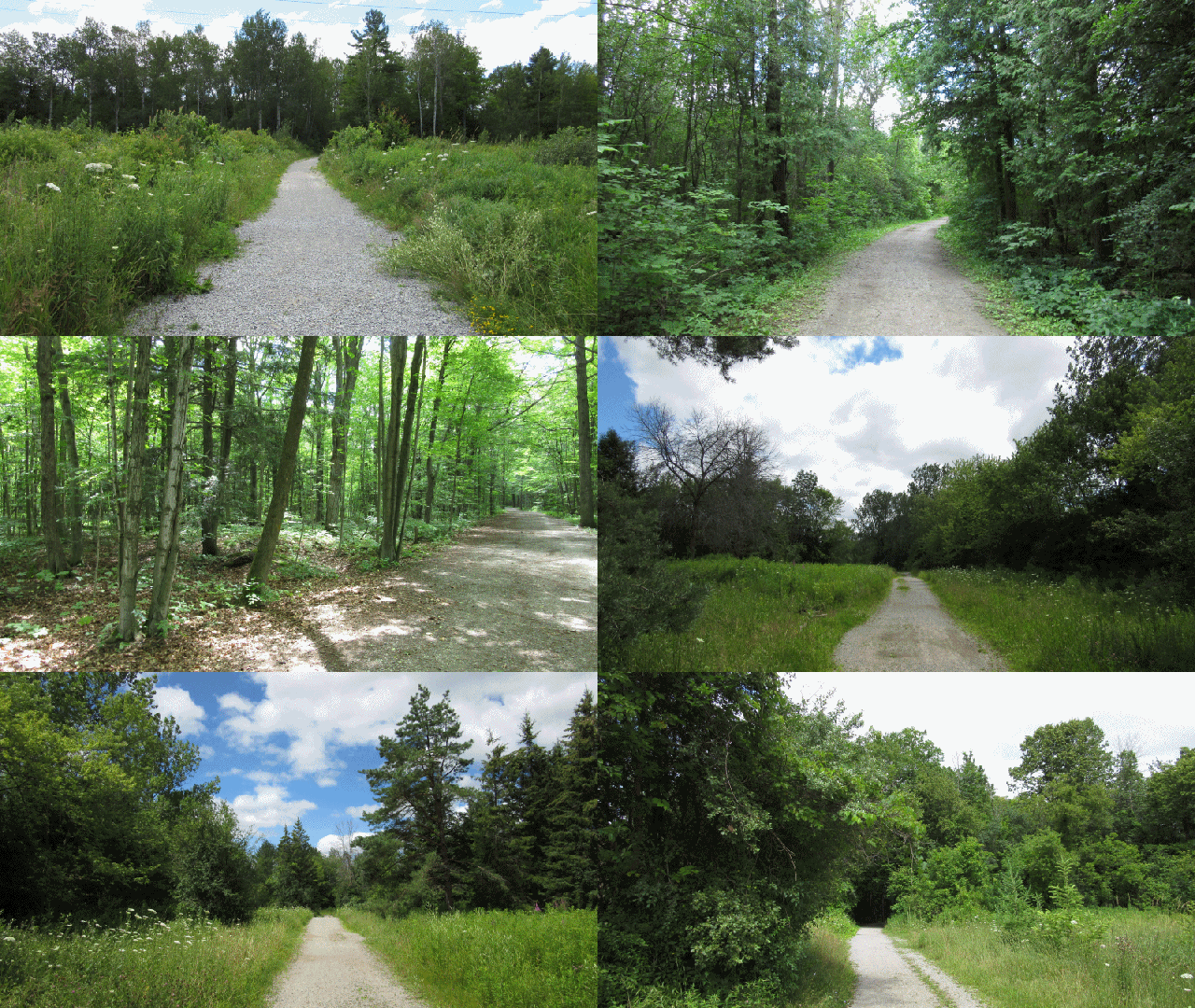
Heber Down’s trail system is quite varied, versatile, and accessible from a number of places beyond the two paid parking lots.

The Devil’s Den Trail (2.5 km)
From the main parking lot, this trail crosses a coupla bridges and meanders along to a sizeable pond which can be circled. This is where most people seem to stop and return to the main lot and picnic area, or branch off onto the Springback Trail for it’s famous staircase (covered below).
The hill on the far side of the pond (from the two lookouts) is a tad steep but we climbed the trail anyway, and were handsomely rewarded for our efforts. A quiet, clean, sandy trail along the ridge with a unique topography totally unlike the valley we’d climbed up from, eventually led back down to the main parking lot. I should mention, you might hear a strange high pitched wailing sound or even something like a chainsaw as you crest the hill. If you do, just take a short stroll off to your left and you’ll be treated to an aerial display of radio controlled aircraft. There’s a field the local RC Club uses just over the hill to your left. If you continue walking this way, (the Joe Drumm Trail) you’ll come upon the Cochrane St parking lot, and access point (from Hwy #7).
If you’re not in the mood for a steep climb up to the ridge of the Devil’s Den Trail, I would suggest you start this trail, not from the main access (to the left of the washrooms), but from the trail off to the right of the washrooms. The grade is much less aggressive from this direction.
The Railway Trail (3.0 km)
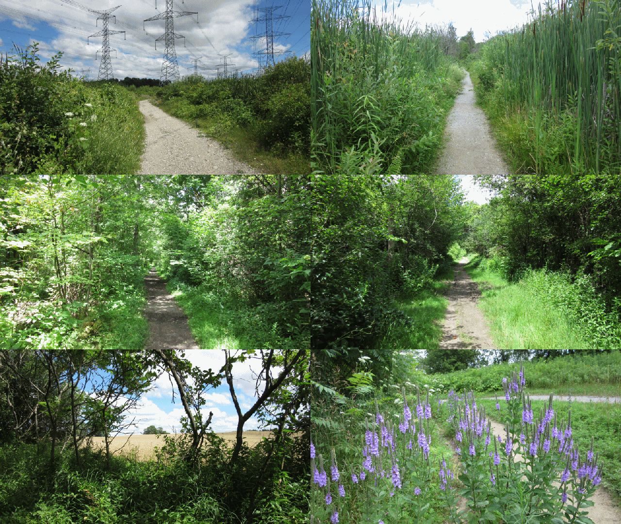
This one kinda “piggy-backs” off the Devil’s Den Trail, yet it’s also accessible from the end of Lyndebrook Rd., or from what I (and I alone, since there’s no official name for it) call the “Hydro Tower Loop” at the end of Spencers Rd. It takes you through open meadow with a mess of wildflowers and butterflies. Then it traverses along a very straight section which was the old 1800’s Canadian Northern Railway berm, through a wetland. Then it joins the Devil’s Den Trail for awhile before returning to Lyndebrook Rd. Accessing from Lyndebrook rd. or Spencers rd. will provide a nice level walk (and no parking fee).
Yeah, Yeah, I know. About 1/3 of this trail is walking under Hydro towers. But personally, I don’t care. If it weren’t for those towers, there’d never be such a well maintained trail through that corridor providing habitat for plants, butterflies, and animals. And for that matter, if it weren’t for the railway over a century ago, we couldn’t walk through the living wetland here either. I realize it’s a trade-off, but worse eco-deals have been made (and will continue to be made).
The Hydro Tower Loop (3.0 km)
This one isn’t on the official trail map, and initially, we didn’t know it was a loop. We thought it was just another way to access the Railway Trail while avoiding the hill on the Devil’s Den Trail, and/or to avoid the parking fee. However, we noticed a split In the trail, so we walked the South side trail (as it coursed alongside a grove of trees blocking the view of the hydro towers) until we hit the Railway Trail to confirm that it went all the way across. Then we walked back from the Railway Trail junction on the North side to confirm that it was a loop. The North part does go along under the towers (and I mean right under some towers).
Though not on the official map, “someone” maintains the trail quite well. And I don’t mean just keeping a path mown through the grass. There’s a sturdy little bridge and even patio stepping stones over the wet spots. All this would’ve required powered vehicles and some effort as the patio stones weren’t just tossed off the back of an ATV. They were carefully placed in a straight row following the path. So, someone seems to care. Oddly, there were also “stoop ‘n scoop” or “leash your dog” or some such signs right on some of the hydro tower’s legs as we walked past them.
I’ll make mention here of a fairly wide and intriguing trail to the South just at the sturdy little bridge on the South side of the loop. We walked it, since it didn’t say not to. It just followed a diagonal course a little further back down Ashburn Rd (which we were parked on), where we found PRIVATE PROPERTY / NO TRESPASSING signs facing the road (which we had to walk around from behind them, to see). I could’ve contested it, but I figured the trail was canopied with scrubby cedars, and we didn’t see anything interesting or pleasant along it so, he can have it for all I care. Then again, for all I know, he could be the one maintaining the trail too so … you know ?
The Connecting (Cullen Gardens) Trail (2 km one way)
This return trail (the only return trail in this CA) is lovely and wide, running off to the South from the orientation sign just in from Lyndebrook rd. It’s wide enough for 4 to walk side by side, and I suspect it was a driveable road back when this CA was a campground.
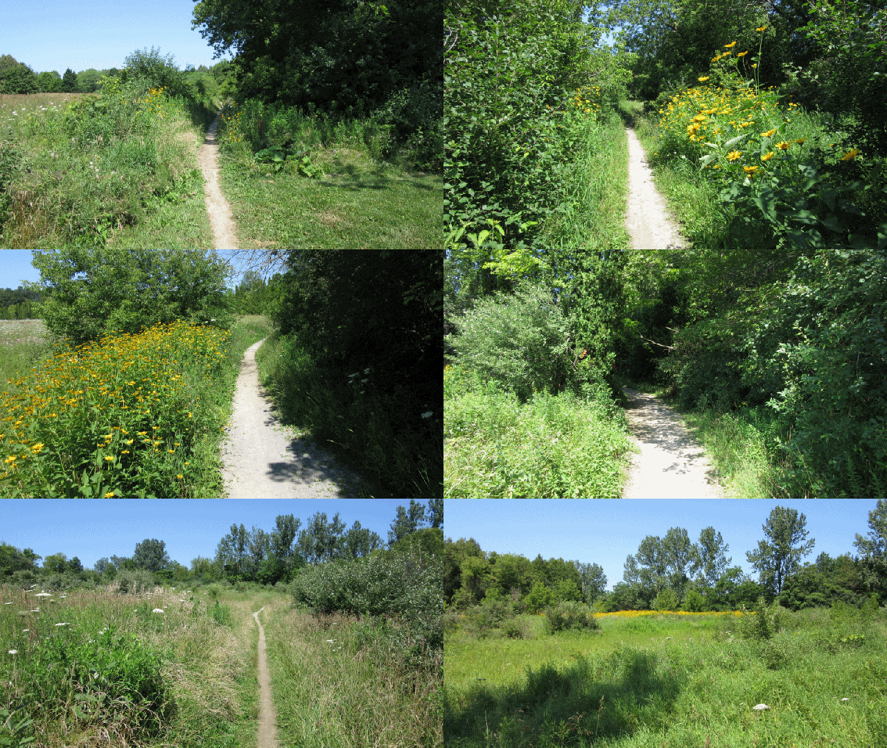
But it’s width ends rather abruptly just past the orientation sign at an overgrown meadow with narrow paths fanning out to the right and the left. Ignore the one going to the right as it appears to go nowhere interesting. However, the two left paths will both take you to the old Cullen Gardens.
I would advise you to follow the left path that turns South almost immediately from the wide Heber Down trail as it goes right past the Cullen Gardens parking lot. We walked up from the Cullen Gardens parking lot on this trail to make sure that was where it went, and it was quite pleasant.
Then, we took the path that went further left before turning South for our return, and had to wade, ankle deep, across a stream to get back to Cullen’s and the car (it was noon by this time and I had no desire to backtrack in full sun). While it was refreshing at the time, our shoes smelled swampy all the way Home.
The Marsh Trail (who cares ? don’t try it)
This one isn’t on the official map either. That’s because it isn’t a trail. Not at all. I mention it just to prevent damage to the marsh and/or saving you a soaker. Just South/West from the parking lot you’ll see a wide trail leading to what appears to be a very wide bridge over a wetland, to a trail around the marsh. We started to follow it, but the “trail” started to fade as I circled the marsh. By the time I realized this trail, was not, it was easier to finish it off than go back. So, enjoy the view from the floating platform, but don’t try to walk any trails from the other end of it.
The Springback Trail (2.2 km)
There are three ways to access the Springback Trail (and all of them are uphill … seriously uphill). One is by taking the trail to the West of the parking lot and over the bridge. The other two are from the Devil’s Den Trail. Before anyone whose looked at this CA from Google Satellite view calls me a liar, yes, there is a level ground access from Coronation rd. However, we walked to it from the Springback Trail, and the signs on the gate make it very clear that access from that point is by authorization only. Besides, if you can climb that gate or circumnavigate the fences running from it … then you can climb the silly-ass hill from the Devil’s Den Trail.
If nothing else, there is one very good reason to walk the Springback Trail. The staircase. The Springback Trail is basically a wander around old re-naturalizing former campsites, and if you didn’t know that, it might fool you. But I gotta admit to being very impressed by the staircase. It’s almost directly West from the Devil’s Den pond and is clearly marked on the map. They even used one of the old Railway piers for the base of the first landing.
The Final Take
Don’t let it’s proximity to Oshawa jade your expectations of this CA. It was a most pleasant surprise as we found it quite appealing. So much so, that we devoted three days to exploring it completely. With occasional spots being the exception, all trails are wide enough for two or more, at the shoulder, to walk comfortably. There are exceptionally fine picnic facilities at the main entrance, and plentiful rest benches everywhere, on these trails. There are permanent washroom facilities ie) not Johnnys – on – the – spot) at both parking lots too.
While all trails inevitably go uphill from the main parking lot, the numerous alternate accesses will provide easier ways onto most trails (The Springback Trail excepted). The noise from the RC aircraft was annoying on some sections of some trails, but nothing serious. However, when we re-visited in November 2023, traffic noise from Hwys 412 and 407 were audible on some sections.
I have listed and reviewed only the official trails (OK with a coupla fanciful exceptions just because I liked them). However, there are dozens upon dozens of obviously well used trails heading off in every direction, everywhere, in this CA. If you wanna use the parking lots, it’ll cost you a measly $6.00 for the whole day (only by credit card). A pretty cheap date eh ?
Have a nice walk,
Bushwhacker


Nice pictures, I especially like the ones with flowers.
LikeLike
Thanks Jacy,
I’m gonna have to get back to composing my photos better. Lately I’ve just been aiming and shooting without even trying to compose properly. I used to take good pictures when they used to cost me. Thanks for the reminder to take the art seriously again.
Bushwhacker
LikeLike
So, again, you manage to hit upon a topic of great interest to me! Are you receiving transmissions from my brain somehow?!
Anyway, great review. I’ll be hitting this location soon. (Oh, and thanks for the tips about the Crown Land atlas… I think I forgot to say that earlier.)
LikeLike
Receiving transmissions from your brain ? That might explain why I’ve been craving … ummm … never mind. Have fun with that atlas. Poking about with the buttons will reveal lots of interesting, official data.
Bushwhacker
LikeLike
Bwaahhahaa… trust me, you don’t want to act on those cravings!
By the way, I’m referencing this review in a Meetup event I just created. I haven’t set the date yet, but it will be soon.
https://www.meetup.com/Short-Fast-Hikes-Scarborough-Pickering-Ajax/events/242468685/
LikeLike
Enjoy your short-fast hike Bill. I hope you have lots of company for it.
Bushwhacker
LikeLike
Hey Bushwhacker! We hiked this area today. Your review really helped me plan the hike, and everyone (all 12) seemed to enjoy it quite a bit. Next time you happen to be at Cullen Park, check out the area to the east of the parking lot. There’s a nice veteran’s memorial garden back there and some pretty paved trails that wind around and cross over the creek.
Thanks!
LikeLike
Here’s the overview of that area… on the way back from Heber Down, we cut off to the east, slid past the playing field, and down into the woods. Very pretty area down there next to the creek. You can walk around a bit down there, fool around at the old putt-putt course amidst the trees, and then come back up to the parking lot through the gardens.
https://goo.gl/photos/NWDXQ9M5R8prjxZv7
LikeLike
Thanks much Bill. We’re gonna get there someday soon.
Bushwhacker
LikeLike
Now who’s picking up transmissions from whose brain Bill ? In the last paragraph of “The Connecting (Cullen Gardens) Trail” Review, I advised avoiding a trail to Cullen that involved wading across a stream (which of course we did). Well, that trail led right into those old gardens. I thought they’d been abandonned for years and was thrilled to see someone has been maintaining them nicely. So … I added the old Cullen Gardens to my list of “trails to be reviewed”. However, you appear to have beat me to it, which is just as well. The last coupla weeks we’ve been exploring the dozens of trails between Uxbridge and Pickering and the 5 trails at Long Sault, so I haven’t had time. We just returned from walking the Lower Trent Trail (Just off the Bleasdell Boulder) today, ’cause I’m tired of all the hills at Long Sault, and found it connects to 45 kms worth of trails North from there ! And I still haven’t taken the wife to High Falls or The Gut as I’d promised a month ago. No rest for the wicked I suppose.
Bushwhacker
LikeLike